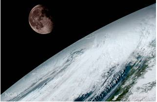
GOES-16 Satellite Broadcasts New Images Of Earth
Stunning new photos of Earth from the GOES-16 satellite give a whole new perspective of our planet.

More stories from Alexandra Rapp
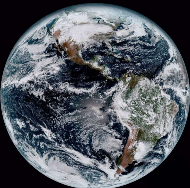
Our home planet is thrown into a whole new light in new photos by taken by NASA. Taken by a new, top of the line satellite, the high definition photos are absolutely stunning.
The GOES-16 satellite is one of these newest and best in Earth-monitoring systems launched by the U.S. National Oceanic and Atmospheric Administration, or NOAA. Launched last November, the GOES-16 observes Earth at approximately 22,300 miles above the surface.
In January, the satellite sent the first series of images from its Advanced Baseline Imager instrument. These images show our planet in breathtakingly vivid detail that we couldn’t necessarily see before.
“The GOES-16 is even better than we imagined,” said Steve Goodman, the satellite’s program officer at NASA, according to National Geographic.
The satellite imaging produces an incredible views of the hemispheres of the Earth with four times the resolution of any other GOES satellite. It can provide a full image of the entire continental U.S. every five minutes and a full image of Earth every fifteen.
“I think it’s pretty cool,” said sophomore Thomas Ruminski. “It’s crazy how high of a resolution they can take pictures at from a satellite orbiting Earth.”
 NOAA/NASA
Her favorite quote is "She wasn't looking for a knight, she was looking for a sword." - atticus.